
Hellfest
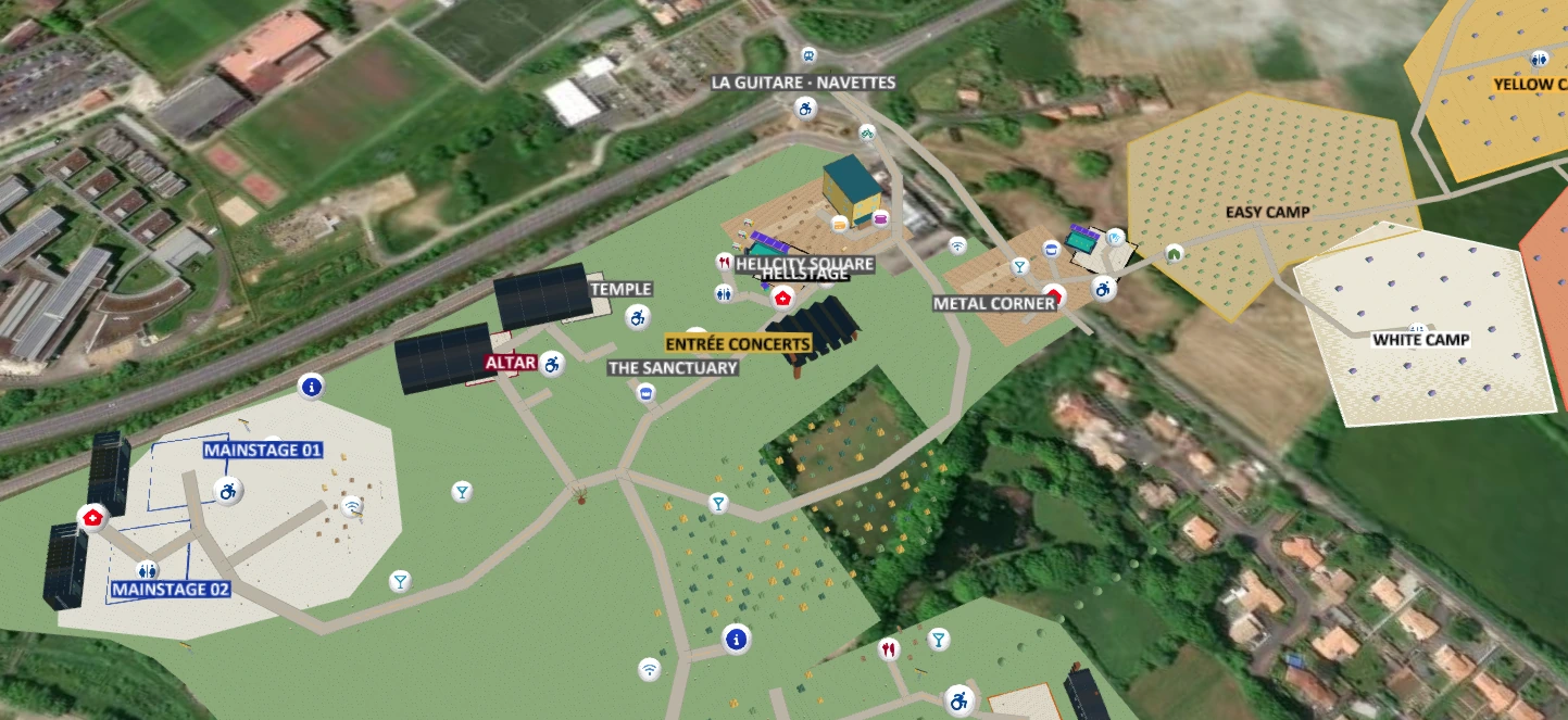
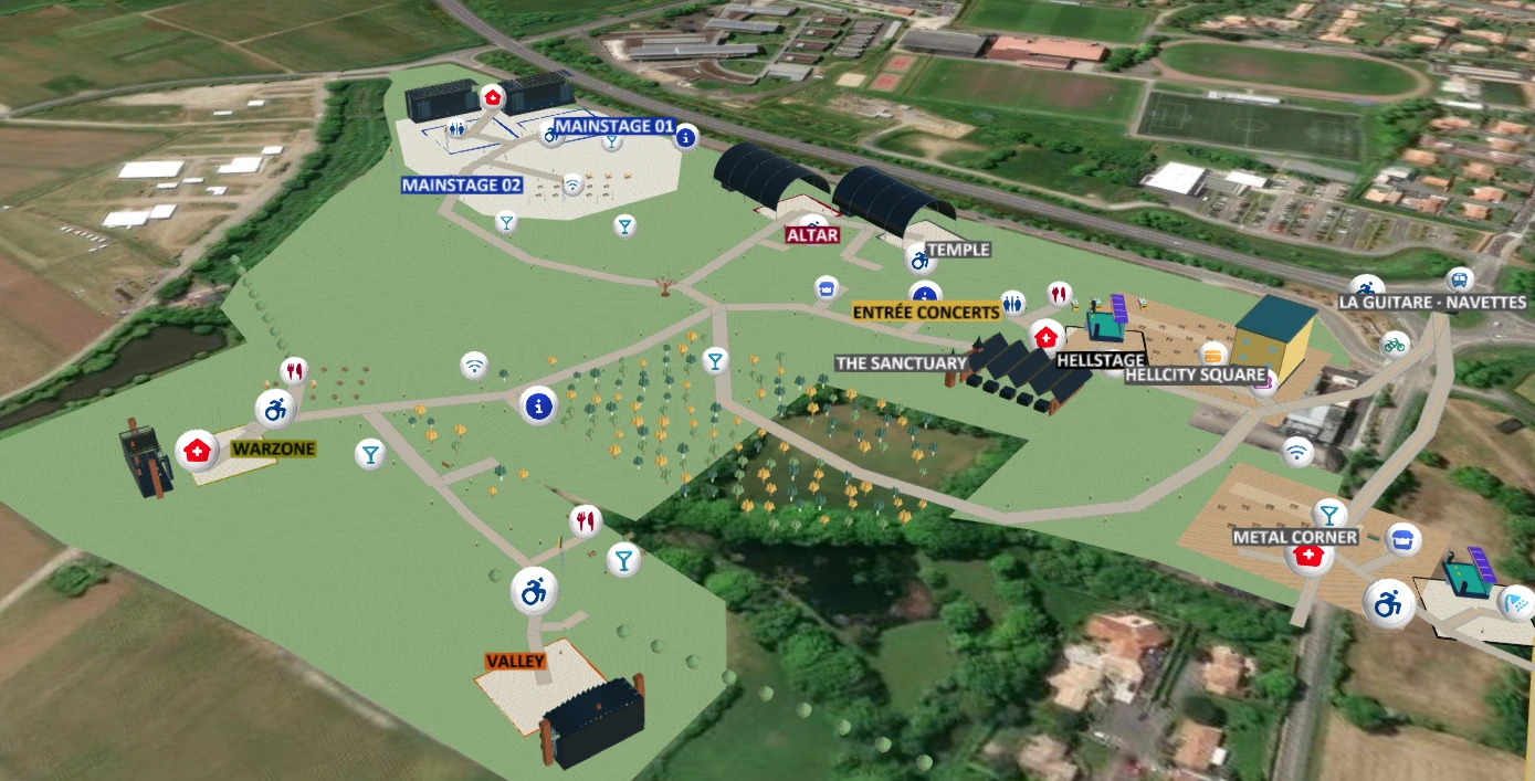
From the main stages to Hellcity Square and the camping districts, discover how a festival map connects performances, meeting points and everyday essentials across an open-air site.
FESTIVALS. ONE PLACE, A THOUSAND DISCOVERIES.
Create an interactive festival map with stages, camping areas, entrances, exhibitors and visitor services. Help visitors plan their visit and find their way with a 2D or 3D map shared by QR code or link.
THREE FESTIVALS. THREE WAYS TO EXPLORE.
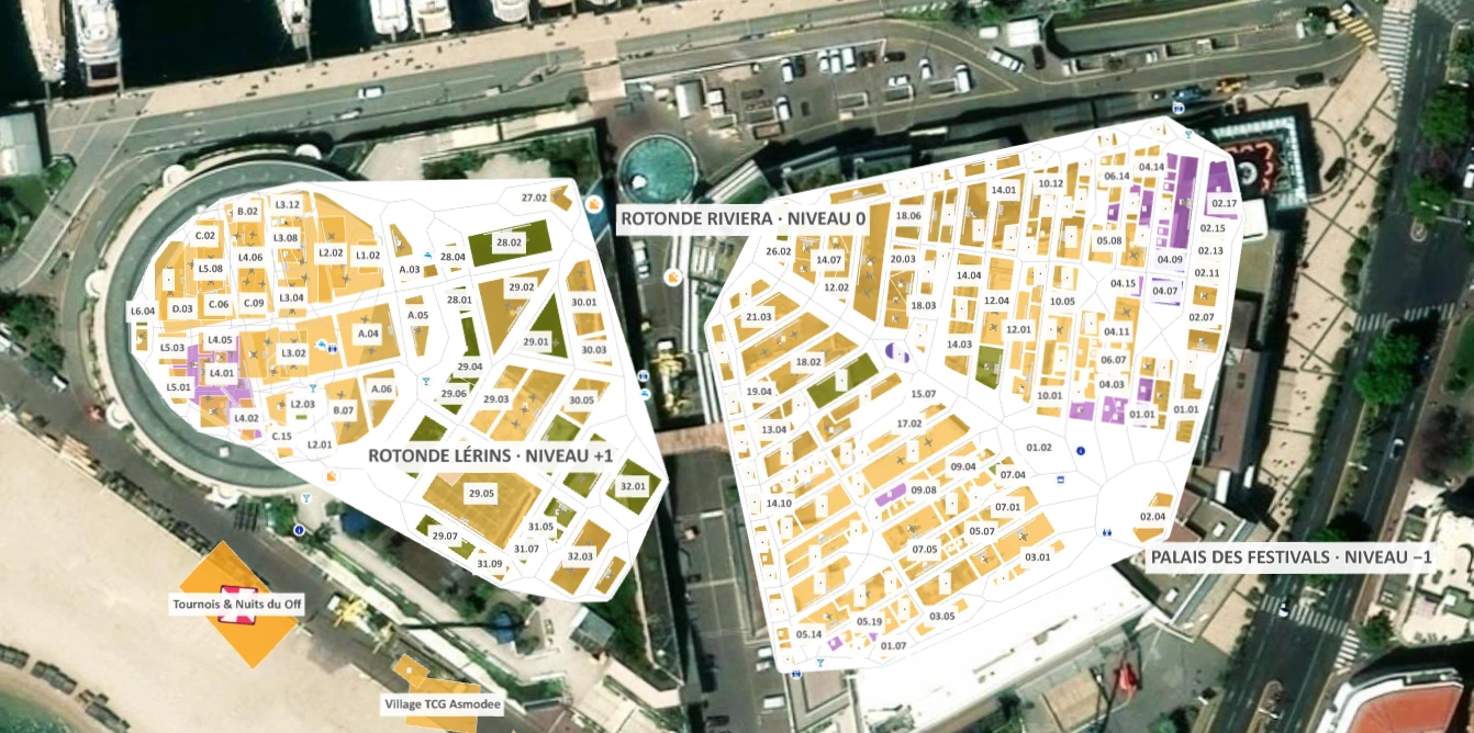
See how festival maps bring together stages and camping at Hellfest, seating and entrances at Carnaval de Rio, and exhibitor stands at the Festival International des Jeux in Cannes.
From the main stages to Hellcity Square and the camping districts, discover how a festival map connects performances, meeting points and everyday essentials across an open-air site.
Explore the Sambadrome, from the parade avenue to the grandstands and Apotheosis Square. Named sectors, entrances and visitor services help spectators understand the venue before they arrive.


CANNES · PALAIS DES FESTIVALS
An exhibition map with individual stands, gaming areas and visitor services across three levels of the Palais des Festivals.
Show exhibitor stands, shared spaces and visitor services across the main exhibition hall, Rotonde Riviera and Rotonde Lérins, with a clear view of each level.

YOUR VENUE, BEAUTIFULLY CONNECTED
From setup to live tracking, every step in Ki Position is built to be effortless so you can focus on your event, not your tools.
Add icons, lines, polygons, and rectangles to visually design your entire campsite layout with accurate measurements.
Visitors and staff can locate themselves instantly and navigate to any facility or assigned pitch using their phone's GPS.
Provide a simple QR code for instant map access at the entrance. No app download required for anyone.
Work with your team in real-time. Assign participants, vendors, or partners directly on the map for seamless coordination.
Define clear routes for vehicles, pedestrians, or emergency access. Guide everyone safely with one-way and two-way paths.
Our lightweight 2D maps load instantly and are highly optimized for mobile devices, consuming minimal battery.
GIVE YOUR VISITORS A BETTER WAY
Make your next visitor’s first impression a great one.