Skip to content
ki position.

PARKS, MADE EASIER TO EXPLORE

A better way to discover a park.

From the gate to the garden. Give visitors one interactive map for paths, landmarks and useful facilities, with a clear 2D view and an inviting 3D view.

3D Ki Position map of the Jardin du Luxembourg in Paris
Jardin du Luxembourg · Paris · 3D
Find the landmarksShow gardens, water, play areas and services on the same map.
See it in 2D and 3DLet visitors choose the view that makes the park easiest to understand.
Share it at the gateOpen the visitor map from a link or QR code, with no app download.

TWO PARIS PARKS, TWO WAYS TO EXPLORE

Real places.
Maps made to discover them.

These independent demonstration maps use mapped park geography to make entrances, paths, water and landmarks easier to see.

01 / PARIS

Jardin du Luxembourg

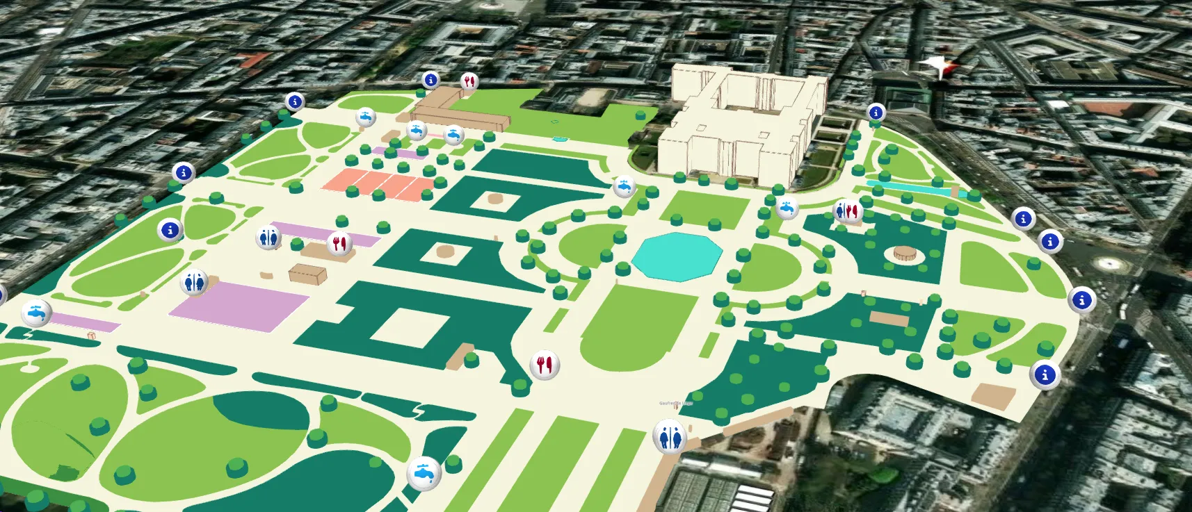
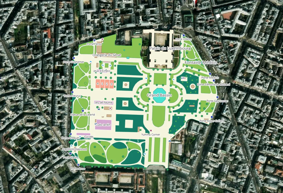
Formal gardens, the Grand Bassin and the Palais du Luxembourg come together in one view. Switch between the 2D plan and a 3D scene with raised tree canopies and building forms.
Open the live map ↗
Jardin du Luxembourg map in 3D with gardens, basin and palace
Jardin du Luxembourg · 3D view
Jardin du Luxembourg map in 2D over the surrounding streets
Jardin du Luxembourg · 2D view

Independent demonstration maps based on public geography. Illustrative tree forms and unverified amenities should not be used as official visitor guidance. Jardin du Luxembourg official brochure ↗
02 / PARIS

Parc Monceau

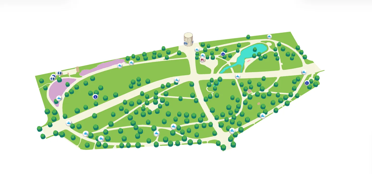
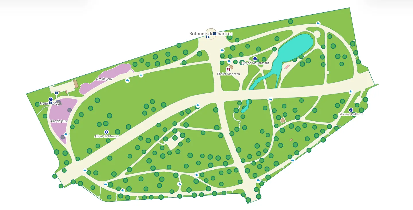
Curving walks connect the lake, playgrounds and Rotonde de Chartres. The 3D view gives the trees and landmarks a sense of place; the 2D plan keeps every route easy to scan.

Parc Monceau 3D map with trees, lake and Rotonde de Chartres
Parc Monceau · 3D view
Parc Monceau 2D map with paths and the lake
Parc Monceau · 2D view

Independent demonstration maps based on public geography. Illustrative tree forms and unverified amenities should not be used as official visitor guidance. Parc Monceau city information ↗

YOUR VENUE, BEAUTIFULLY CONNECTED

Why Organizers Choose Ki Position?

From setup to live tracking, every step in Ki Position is built to be effortless so you can focus on your event, not your tools.

Design with Precision

Add icons, lines, polygons, and rectangles to visually design your entire campsite layout with accurate measurements.

Real-Time Geolocation

Visitors and staff can locate themselves instantly and navigate to any facility or assigned pitch using their phone's GPS.

Instant QR Code Sharing

Provide a simple QR code for instant map access at the entrance. No app download required for anyone.

Collaborative Planning

Work with your team in real-time. Assign participants, vendors, or partners directly on the map for seamless coordination.

Smart Routing & Paths

Define clear routes for vehicles, pedestrians, or emergency access. Guide everyone safely with one-way and two-way paths.

Ultra-Fast Performance

Our lightweight 2D maps load instantly and are highly optimized for mobile devices, consuming minimal battery.

A great visit starts
with a clear direction.

Build your first map

GIVE YOUR VISITORS A BETTER WAY

Good places deserve
to be found.

Make your next visitor’s first impression a great one.